| Special Geographical Unit: | Andrews Wildlife Management Area |
| Verbatim Directions to Locality: | Suwannee River floodplain - study site V2-21 for USGS report, PP 1656A; east side of floodplain; Andrews WMA |
| Latitude - degree: | 29 |
| Latitude - minutes: | 32 |
| Latitude - seconds: | 48 |
| Latitude Direction Flag: | N |
| Longitude - degree: | 82 |
| Longitude - minutes: | 57 |
| Longitude - seconds: | 21 |
| Longitude Direction Flag: | W |
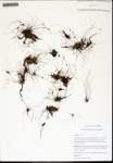
| Habitat: | glade-like shallow depression roughly 40 m across; heavy ground cover, few tress; limestone boulder on edge |
| Non digital information?: | N |


