| Special Geographical Unit: | Falling Waters State Park |
| Verbatim Directions to Locality: | Beside road to campground area, ca. 3 mi S of Chipley |
| Latitude - degree with decimals: | 30.73131 |
| Latitude Direction Flag: | N |
| Longitude - degree with decimals: | 85.53243 |
| Longitude Direction Flag: | W |
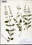
| Habitat: | In loamy sand of small clearing in mesic pine-oak woodland |
| Plant Morphology Observations: | Upper leaf surface with septate (i.e., multicellular) trichomes |
| Local Abundance Observations: | Frequent |
| Notes: | Loran C. Anderson - First county record for the Atlas
|
| Non digital information?: | N |
