| Special Geographical Unit: | Juniper Creek Wildlife Management Area |
| Verbatim Directions to Locality: | by road 020 of Juniper Creek Wildlife Management Area at edge of Jones Branch of Juniper Creek, ca. 4 mi W of Clarksville. |
| Latitude - degree with decimals: | 30.40341 |
| Latitude Direction Flag: | N |
| Longitude - degree with decimals: | 85.26146 |
| Longitude Direction Flag: | W |
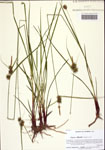
| Habitat: | in wet sandy loam [at edge of creek] |
| Local Abundance Observations: | Frequent |
| Notes: | Loran C. Anderson - First county record for the Atlas.
|
| Non digital information?: | N |
