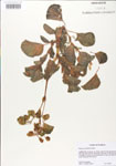
| Verbatim Directions to Locality: | just east of SR 561A & 2.6 miles W of SR 27 and Minneola. |
| Latitude - degree: | 0 |
| Latitude - minutes: | 0 |
| Latitude - seconds: | 0 |
| Latitude - degree with decimals: | 0 |
| Longitude - degree: | 0 |
| Longitude - minutes: | 0 |
| Longitude - seconds: | 0 |
| Longitude - degree with decimals: | 0 |
| Township: | 22S |
| Range: | 23E |
| Section: | 35 |
| USGS Quad Number: | 28081 E-7 |
| Habitat: | in sandy exposed soils associated with lake bed of Lake Minneola. |
| Local Abundance Observations: | common. |
| Non digital information?: | N |
