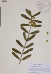
| Verbatim Directions to Locality: | in dry loamy sand of longleaf pine flatwoods (burned earlier this season) in Apalachicola Nat'l Forest between Rte 61 and Hwy 319. |
| Latitude - degree with decimals: | 30.33571 |
| Latitude Direction Flag: | N |
| Longitude - degree with decimals: | 84.31488 |
| Longitude Direction Flag: | W |
| Habitat: | with wiregrass and bracken in dry loamy sand of longleaf pine flatwoods (burned earlier this season). |
| Local Abundance Observations: | infrequent. |
| Notes: | Loran C. Anderson - First county record for the Atlas.
|
| Non digital information?: | N |
