| Verbatim Directions to Locality: | 6.5 mi. W of SR 73. Juniper Creek. Ron&Gail Wood. |
| Latitude - degree with decimals: | 30.43209 |
| Latitude Direction Flag: | N |
| Longitude - degree with decimals: | 85.29045 |
| Longitude Direction Flag: | W |
| Habitat: | Low sandy mount on slope above pond. No canopy. |
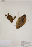
| Plant Morphology Observations: | Erect to prostrate herb to 36 cm. Spines gray & circular in cross-section. Bud bracts dark green. Smells very edible @ 200 degrees after 3 hours. |
| Local Abundance Observations: | Locally Infrequent |
| Non digital information?: | N |
