| Special Geographical Unit: | Santee National Wildlife Refuge |
| Verbatim Directions to Locality: | Santee National Wildlife Refuge, Pine Island Unit, 5.0 mi NE of Vance. Low woods just north of entrance road, 0.3 mi east of Colclough Pond, ca. 1.2 mi east of entrance at intersection [of] SR400 and Francis Marion Rd. |
| Altitude (in meters): | 35 |
| Latitude - degree with decimals: | 33.486765 |
| Latitude Direction Flag: | N |
| Longitude - degree with decimals: | 80.365101 |
| Longitude Direction Flag: | W |
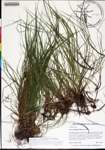
| Habitat: | In low woods with Quercus nigra, Quercus laurifolia, Liquidambar |
| Non digital information?: | N |
| Identifier's Name: | Keith A. Bradley |
| Formal Identification Date: | 2017-05-01 |
| Lowest Rank Identified: | Species |
| Identification History: | Carex emmonsii Dewey ex Torr. |
| | |
| | |
| Identifier's Name: | Katelin D. Pearson |
| Formal Identification Date: | 2018-02-12 |
| Lowest Rank Identified: | first Infraspecific Epithet |
| Further Identification Comments: | (Carex emmonsii Dewey ex Torr. is synonym)
This is an update of the species name to make it consistent with The Plant List (www.theplantlist.org/) and other resources, as accessed February 12, 2018. It is not meant to reflect verification of the previous identification. |
| Identification History: | Carex albicans var. emmonsii (Dewey ex Torr.) Rettig |
| | |
| | |
