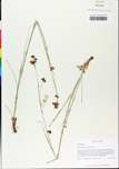
| Verbatim Directions to Locality: | Burned, partially cutover, upland longleaf pine savanna, on S side of 1-10, ca. 1.2 mi W of int US 19, ca. 0.7 mi E of Co Rd 259 bridge, ca. 7.3 mi E or int FL 59 to Lloyd; NEQ, NEQ, Sec. 22, T1N, R4E; Waukeenah 7.5' Quad.; 30 degrees 28'40"N, 83 degrees54'36"W. Elev. 180-200 ft. Soils -Dothan (Plinthic Paleudults). |